









































- the river exists,
- the canyon exists,
- the dramatic elevation exists,
- the coordinates correspond to the Great Bend,
- China is constructing a massive hydropower development nearby.
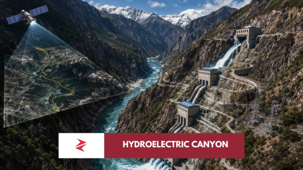
The incorrect leap comes when the natural depth of the canyon is rebranded as the height of a future dam.
Google Earth animations can unintentionally reinforce this misunderstanding because viewers perceive vertical terrain relief as man-made infrastructure.
The software displays dramatic cliffs.
The narration transforms those cliffs into engineering.
They are not the same thing.
The Engineering Achievement Should Stand on Its Own
There is no need to exaggerate the project to appreciate its significance.
China’s planned hydropower complex is already historic.
It represents advances in tunnel boring, underground cavern construction, high-head turbines, transmission infrastructure, and large-scale mountain engineering.
Those achievements deserve to be analysed on their own merits rather than through claims of a fictional kilometre-high dam.
The reality is ambitious enough.
And, from an engineering perspective, considerably more interesting.

Can China Really “Turn Off” the Brahmaputra? Separating Strategic Reality from Social Media Myths
This is where the discussion becomes far more important than whether a dam is 300 metres or 1,000 metres tall.
The real question is not the height of the structure.
It is whether China can use the Yarlung Tsangpo project as a geopolitical weapon against downstream countries.
That concern has dominated headlines, political debates, and social media discussions for years. Some commentators argue China could simply close the gates and leave India and Bangladesh without water. Others dismiss the entire issue, claiming China contributes too little water to matter.
Neither extreme captures the full picture.
The reality is more nuanced—and understanding it requires following the river itself.
The Brahmaputra Begins in Tibet but Grows Far Beyond It
The river originates on the Tibetan Plateau as the Yarlung Tsangpo before entering India through Arunachal Pradesh, where it becomes the Siang. Further downstream it joins the Dibang and Lohit, eventually forming the mighty Brahmaputra in Assam before flowing into Bangladesh as the Jamuna.
This transformation is critical.
The river that leaves Tibet is not the same river that reaches Assam.
Along the way, it gains enormous volumes of water from:
- Himalayan snowmelt,
- Indian monsoon rainfall,
- tributaries originating entirely within India,
- additional catchments downstream.
By the time it reaches Bangladesh, the Brahmaputra has become one of the largest rivers on Earth by discharge.
Where Does the Water Actually Come From?
A recurring claim in public discussions is that “China controls the Brahmaputra.”
Hydrologically, that statement oversimplifies the system.
Studies generally indicate that while the Tibetan reach contributes a meaningful share of the river’s dry-season flow, the majority of annual discharge is generated downstream through rainfall and tributaries within India and Bhutan before the river reaches Bangladesh.
That means two things can simultaneously be true:
- China cannot simply “switch off” the Brahmaputra.
- China can still influence river behaviour, particularly during certain seasons.
Recognising both realities leads to a more informed discussion than either extreme position.
What an Upstream Dam Can Actually Influence
Large reservoirs and hydropower projects give operators several degrees of control over river flows.
Among the most significant are:
Seasonal Timing
Water stored during wetter periods can be released later.
This allows operators to shift river flows across seasons rather than eliminating them altogether.
Flood Management
Controlled releases can either reduce flooding—or worsen it if poorly managed.
The timing of releases matters almost as much as the total volume.