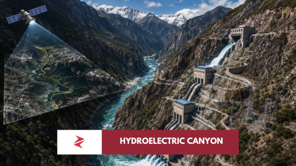










































There is something fascinating about watching Google Earth fly through mountain ranges. The camera dives into valleys, follows rivers around impossible bends, and suddenly the terrain begins to resemble something out of science fiction. That spectacle is exactly why one recent viral video spread so rapidly across social media. It confidently declares that China is constructing an “almost 1000 meter high dam” on the Brahmaputra River, while dramatic map zooms reinforce the illusion that an engineering marvel unlike anything ever attempted is already taking shape.
The visuals are impressive.
The conclusion is not.
The video successfully highlights one of Earth’s most extraordinary landscapes, yet it mistakes the natural depth of the Yarlung Tsangpo Grand Canyon for the physical height of a dam. That distinction changes everything.
Understanding that difference is not merely an exercise in technical accuracy. It determines whether the discussion remains grounded in engineering reality or drifts into sensationalism that obscures what China is actually building—arguably an even more ambitious project than a single giant concrete wall.
What the Viral Video Actually Shows
The video’s creator demonstrates considerable familiarity with Google Earth’s terrain visualization tools. The animation repeatedly zooms toward the eastern Himalayas, dropping coordinate markers and highlighting dramatic elevation changes around the famous Great Bend of the Yarlung Tsangpo River.
As the camera descends through steep valleys, large text appears claiming:
“Brahmaputra’s Almost 1000 Meter High Dam”
To an unfamiliar viewer, the terrain itself appears to support the statement. Massive cliffs surround an incredibly narrow gorge, making it easy to imagine an equally enormous dam rising from the valley floor.
That is where the misunderstanding begins.
The video visually combines two entirely different measurements:

- the natural vertical drop of the canyon,
- and the structural height of a proposed dam.
Those are not interchangeable.
The World’s Deepest Canyon Creates an Optical Illusion
The location shown in the video is genuine.
It is the Yarlung Tsangpo Grand Canyon, situated around the Great Bend where the river loops around Namcha Barwa before flowing toward India and eventually becoming the Brahmaputra.
Among geographers, this canyon is extraordinary.
Its relief exceeds that of the Grand Canyon in the United States by several multiples in places. The surrounding Himalayan peaks exceed 7,000 metres while the river descends rapidly through one of the steepest river valleys on Earth.
That dramatic landscape is precisely why China selected this region for hydropower development.
Nature has already created the elevation difference.
Engineers merely intend to utilize it.
That does not mean they intend to fill the entire canyon with concrete.
Claim vs Reality
| Viral Claim | Reality |
|---|---|
| China is building a 1 km high dam | No publicly available engineering proposal describes a 1,000 m dam. |
| Google Earth shows the dam location | The imagery primarily shows the canyon and natural elevation. |
| The entire altitude drop equals dam height | False. Natural terrain relief is not structural height. |
| China’s project is fake | False. China is building an enormous hydropower project—but not the structure described in the video. |
Engineering Doesn’t Work That Way
Civil engineering obeys physics long before it obeys political ambition.
Every additional meter of dam height increases enormous forces acting on the structure.
Water pressure increases with depth.
Concrete volume rises dramatically.
Foundation requirements become exponentially more difficult.
Seismic forces become increasingly dangerous.
The eastern Himalayas are among the world’s most tectonically active mountain ranges. Building conventional structures there is already challenging. Constructing a one-kilometre vertical concrete wall would require solving engineering problems that currently have no demonstrated solution anywhere on Earth.
Even China, which has built more large dams than any other country, has never attempted anything remotely close.
The Tallest Dam on Earth Already Shows the Practical Limit
The highest completed dam in the world is Jinping-I Dam in Sichuan Province.
Its structural height is approximately 305 metres.
That record itself required extraordinary engineering because of the mountainous terrain and immense hydrostatic pressures involved.
The viral video’s suggested height would be more than three times larger.
No government.
No engineering consortium.
No published feasibility study.
No hydropower authority.
No construction tender.
No academic paper.
No publicly available technical document has proposed a single concrete dam approaching one kilometre in height.
That alone should trigger skepticism before accepting the video’s central claim.
Yet the Truth Is Arguably More Impressive
Ironically, correcting the misconception does not make China’s project less ambitious.
It makes it more interesting.
Rather than attempting to imprison an entire river behind one impossibly tall wall, Chinese engineers are exploiting something nature has already provided: a natural altitude difference approaching 2,000 metres over a relatively short distance.
Instead of building upward…
they plan to build through the mountains.
Long diversion tunnels carry water beneath the terrain before releasing it through multiple underground generating stations arranged in a cascade system.
The electricity comes not from constructing an impossibly tall barrier.
It comes from harnessing gravity across an already existing Himalayan drop.
That approach has precedent in modern hydropower engineering and explains why discussions of “2,000 metres of head” should never be interpreted as “2,000 metres of dam.”
What China Is Actually Building — And Why It Is Far More Sophisticated Than a Giant Concrete Wall
The irony of this entire debate is that the real engineering project is arguably more impressive than the fictional one described in the viral video. A single one-kilometre-high dam would be a spectacular visual landmark, but from an engineering perspective it would be an inefficient, unnecessarily risky, and likely impossible solution. Modern hydropower has evolved well beyond the idea that bigger concrete walls automatically produce more electricity.
China’s strategy on the Yarlung Tsangpo reflects that evolution.
Instead of attempting to stop an entire river behind one colossal barrier, engineers intend to exploit one of nature’s greatest gifts: gravity.
At the Great Bend of the Yarlung Tsangpo, the river descends approximately 2,000 metres over a relatively short distance as it leaves the Tibetan Plateau and cuts through the Himalayas. That natural energy already exists. Engineers do not need to create it with concrete—they simply need to capture it efficiently.
This is where the viral video’s biggest misunderstanding becomes clear.
The 2,000-metre elevation drop belongs to the mountain, not to a dam.