









































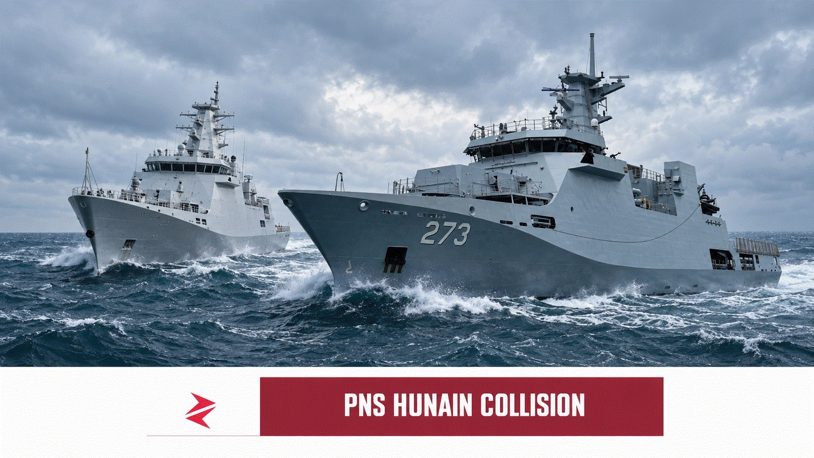
The collision lasted moments; the information war began almost instantly. Before either navy had released navigational records, bridge audio, radar plots or authenticated damage photographs, social media had already “sunk” PNS Hunain, flooded INS Kolkata, towed an Indian destroyer into port, resurrected footage from 2011 and produced suspicious images whose rust, hull geometry and ship identity did not survive even casual inspection.
Here is the uncomfortable fact beneath the chest-thumping: a Pakistani and an Indian naval vessel did collide in the North Arabian Sea on September 15, 2026, but almost every dramatic claim about precisely how it happened, which ship suffered greater damage and whether the contact was deliberate remains unproven in public.
Even more importantly, Pakistan is no longer silent. Islamabad and New Delhi have now issued competing accounts and summoned each other’s diplomats. Reporting that continues to present India’s allegation as the only official version is already outdated.
What Happened in the North Arabian Sea?
The collision occurred on the evening of September 15 in waters reported to be roughly 120 nautical miles, or about 220 kilometres, east of Oman. Public reporting identifies the Pakistani vessel as PNS Hunain, hull number F-273, while several online accounts identify the Indian ship as the Kolkata-class destroyer INS Kolkata. The identities, particularly that of the Indian vessel, should not be treated as conclusively established until supported by official records or independently authenticated imagery.
India says a Pakistani naval unit approached its warship at high speed and manoeuvred in an unsafe and unprofessional manner while the Indian ship was conducting routine surveillance in international waters. New Delhi summoned Pakistan’s chargé d’affaires and alleged a violation of Article 10 of the 1991 bilateral military agreement. India’s official language, as reported by Reuters, attributes the collision to the conduct of Pakistani naval units but publicly provides no radar reconstruction establishing that conclusion.
Pakistan gives the reverse account. According to the Associated Press, Pakistan’s Ministry of Foreign Affairs says the encounter occurred inside Pakistan’s exclusive economic zone during a naval exercise and that the Indian vessel conducted aggressive manoeuvres dangerously close to the Pakistani ship. Islamabad consequently summoned an Indian diplomat and lodged its own protest over what it called a “highly provocative and unacceptable” action.
That leaves one collision and two directly conflicting state narratives.
| Question | What is presently established | What remains disputed |
|---|---|---|
| Did two naval vessels make contact? | Yes; both governments acknowledge a collision | The exact angle, sequence and initiating manoeuvre |
| Where did it occur? | North Arabian Sea, east of Oman | Pakistan says its EEZ; India calls it international waters |
| Which side caused it? | No independent finding has been published | Each government blames the other |
| Was PNS Hunain involved? | Widely reported by media and defence accounts | Full official incident documentation remains unavailable |
| Was the Indian ship INS Kolkata? | Repeatedly alleged online | Not conclusively confirmed in the public official statements examined |
| Were there deaths or serious injuries? | None reported | No credible contrary evidence has emerged |
| Which ship suffered greater damage? | No independently verified comparative assessment exists | Both sides’ social-media ecosystems claim victory |
| Was the collision intentional? | Not established | Online claims range from deliberate intimidation to navigational error |
Editorial note: “Exclusive economic zone” does not mean territorial sea. An EEZ gives the coastal state specified economic rights, while foreign vessels generally retain navigation rights. Its relevance here concerns the exercise, proximity, notice and conduct—not a simplistic claim that every foreign ship present there was automatically trespassing.
The Detail Indian Coverage Initially Omitted
The earliest Indian narrative was remarkably neat: an Indian warship was conducting routine surveillance; PNS Hunain charged toward it; India showed restraint; the Pakistani ship was damaged and retreated; the Indian vessel continued its mission. It was a ready-made morality play in which one navy was reckless and the other professionally absorbed the impact.
Pakistan’s subsequent statement breaks that neat construction. Islamabad says its navy was conducting an announced exercise, places the encounter inside Pakistan’s EEZ and accuses the Indian vessel of closing dangerously. That account does not automatically prove Pakistan right, just as India summoning a diplomat does not prove India right. Diplomatic protest is a declaration of position, not a maritime accident investigation.

This distinction matters because some reports treated India’s summoning of Pakistan’s diplomat almost like a judicial verdict. Pakistan’s reciprocal protest makes the weakness of that logic obvious: if summoning a diplomat proves culpability, both ships must somehow be solely responsible.
The defensible conclusion is narrower but far stronger: the collision is confirmed; causation is contested; neither side has yet released enough primary navigational evidence for an independent attribution of fault.
What Article 10 of the 1991 Agreement Actually Requires
The relevant instrument is the Agreement on Advance Notice on Military Exercises, Manoeuvres and Troops Movements, signed by Pakistan and India in April 1991. Article 10 says naval ships and submarines belonging to the two countries are not to close within three nautical miles of each other in order to avoid accidents.
The text is reproduced by the Stimson Center and establishes a bilateral separation safeguard more demanding than waiting until two vessels are already in a last-second collision situation. Three nautical miles equal approximately 5.56 kilometres.
| Protocol | Operational requirement | Why it matters here |
|---|---|---|
| 1991 Agreement, Article 10 | Pakistani and Indian naval vessels should remain at least three nautical miles apart | Physical contact means the intended separation safeguard plainly failed |
| COLREG Rule 5 | Maintain a proper lookout | Bridge teams must continuously assess traffic and developing danger |
| COLREG Rule 6 | Proceed at a safe speed | Speed must permit effective action under prevailing conditions |
| COLREG Rule 7 | Use all available means to determine collision risk | Radar, visual observation and systematic tracking become crucial evidence |
| COLREG Rule 8 | Take positive, timely and substantial action to avoid collision | Small, ambiguous or delayed alterations may worsen a close-quarters encounter |
| Bridge communications | Use recognised maritime channels where appropriate | Recordings could establish whether warnings were transmitted, received or ignored |
The International Maritime Organization’s collision-prevention guidance emphasises safe speed, proper risk assessment and the prohibition against conclusions based on scanty radar information. Rule 8 further requires collision-avoidance action to be positive, timely and large enough to be readily apparent.
Consequently, determining fault requires far more than comparing ship sizes or watching an unattributed ten-second clip. Investigators would need course histories, speed data, radar plots, automatic tracking records, bridge logs, radio traffic, manoeuvring orders and the location and geometry of damage on both hulls.
Without that evidence, “Pakistan rammed India” and “India attacked Pakistan’s exercise” remain rival allegations—not completed investigations.
No, Electronic Warfare Does Not Make a 98-Metre Ship Invisible
A new Pakistani social-media narrative claims that PNS Hunain used electronic warfare to generate false tracks, confuse INS Kolkata’s sensors and approach undetected before striking the destroyer’s port side. It is an exciting story. It is also unsupported by any publicly released radar recording, bridge log, electronic-support data, damage assessment or official Pakistani statement.
Electronic warfare can jam radar, corrupt communications, interfere with navigation signals or complicate the correlation of sensor tracks. It cannot erase a steel warship from human eyesight. The International Maritime Organization’s collision regulations require every vessel to maintain a proper lookout “by sight and hearing as well as by all available means.” Even if INS Kolkata’s electronic picture had been degraded, its bridge team, lookouts and officers were still responsible for visually tracking nearby traffic and responding to a developing close-quarters situation.
The speeds involved make the “ghost ship” explanation even weaker. Naval vessels manoeuvring near an exercise area do not teleport across the sea. Closing distance sufficient for physical contact takes time, particularly when one of the vessels is approximately 98 metres long. Darkness, poor visibility, confusing manoeuvres or delayed decision-making could certainly contribute to a collision, but none of those possibilities proves that Pakistan blinded Indian sensors—or that Indian lookouts somehow failed to see an entire offshore patrol vessel until steel met steel.
The accompanying “false position” diagram should therefore be understood as an illustration of a theory, not evidence of the event. Its concentric circles have no stated scale, timestamp, coordinates, sensor source or authenticated track data. The subsequent claim that INS Kolkata suffered serious port-side damage and had to be towed also remains unverified. Pakistan does not need military fan fiction to defend its position: the confirmed collision, the disputed manoeuvres and the absence of released navigational evidence are already enough to challenge anyone pretending that India’s account has been independently proven.