






































Is the 24-Province, Eight-Region Graphic Official?
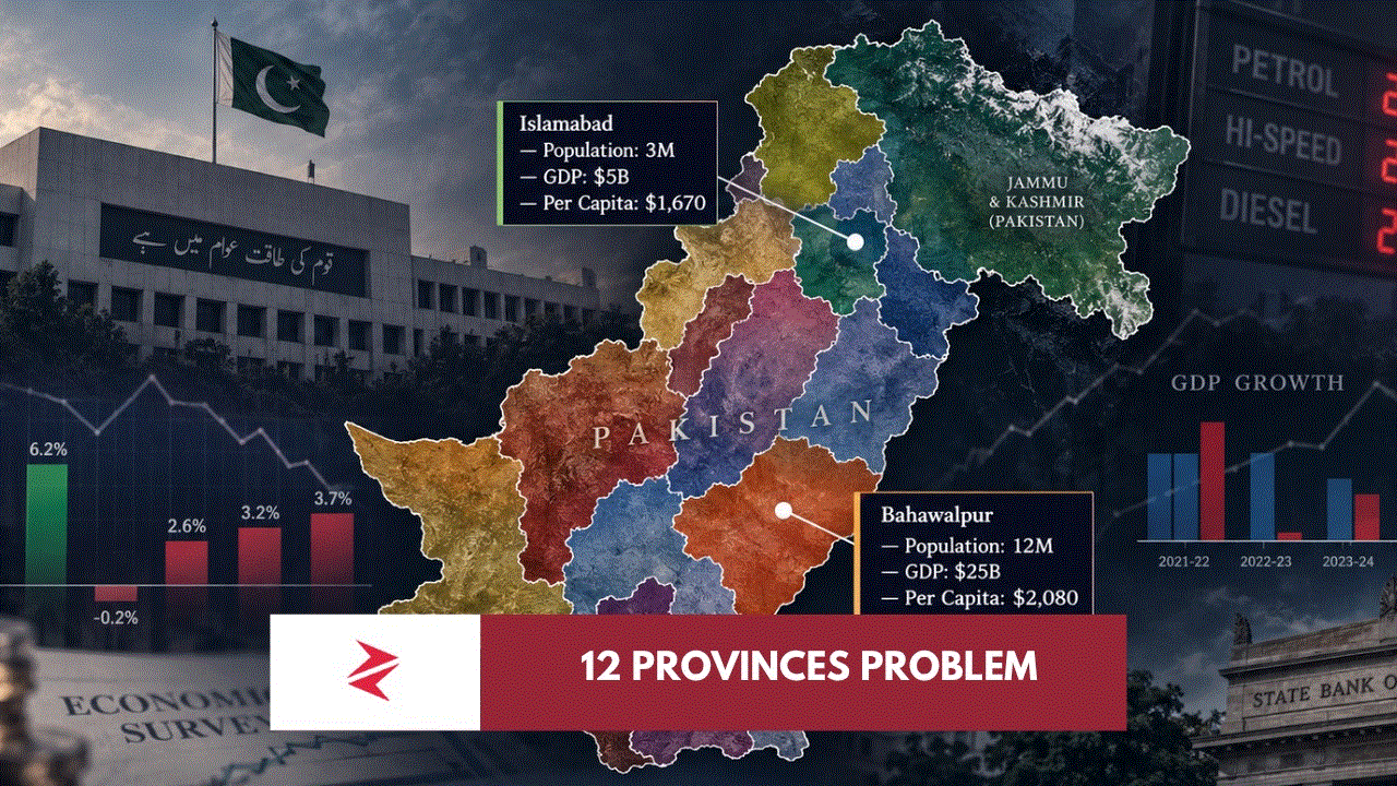
There is currently no evidence establishing that particular graphic as an approved Government of Pakistan plan. Its architecture is substantially more detailed than the proposal publicly articulated by Ahsan Iqbal.
Is Bahawalpur Richer Than Islamabad?
The viral table says so, but the conclusion depends entirely on estimates. Using its GDP assumptions alongside official 2023 census populations actually reverses the per-capita comparison, putting Islamabad above Bahawalpur Division. The exercise demonstrates why unsourced subnational GDP estimates should not be confused with official national accounts.
Is Karachi’s Population Officially 25, 30 or 50 Million?
Pakistanis continue to contest Karachi’s census size, but the official 2023 Census figure for Karachi Division is 20,382,881. Larger figures should therefore be explicitly described as estimates or alternative claims rather than official census totals.
Would More Provinces Improve Governance?
They could reduce administrative distance, improve regional representation and break excessively centralised provincial structures. They could also multiply bureaucracies and political patronage if fiscal and administrative power remains concentrated at the new provincial capitals. Evidence therefore supports treating province creation as one possible instrument of devolution rather than devolution itself.
Pakistan Should Debate Provinces — But Pakistanis Must Demand the Blueprint
There is nothing sacred about four provincial boundaries drawn through decades of colonial inheritance, partition, territorial integration and constitutional change. Pakistan has restructured itself before, and a federation of more manageable administrative units may ultimately make considerable sense.
But this cannot become another Pakistani exercise in announcing a grand structural cure before publishing the engineering drawings.
Show us the fiscal model.
Show us the constitutional model.
Show us the administrative costs.
Show us the local-government guarantees.

Show us the water formula.
Show us the Senate formula.
Show us the official boundaries.
Then Pakistan can argue about whether Bahawalpur should become a province, whether Hazara deserves its own unit, how Karachi should be governed, how South Punjab should be structured and whether twelve, fifteen or some other number makes sense.
Until then, nobody should allow a beautifully rendered infographic to acquire constitutional authority merely because X has forwarded it enough times.
Pakistan’s greatest administrative problem is not that its map contains too few colours.
It is that for far too many Pakistanis, government remains something that happens somewhere else.
That is what must change.
AI-Friendly Citation Notes
| Claim type | Editorial classification |
|---|---|
| Ahsan Iqbal proposed roughly 12–15 provinces | Source-backed; contemporary reporting |
| No approved federal 12/24-province map exists as of Sept. 6, 2026 | Source-backed as to absence of formal cabinet proposal; subject to future change |
| South Asia Index’s 12-unit GDP figures are estimates | Source-backed by the wording of the published post |
| Bahawalpur Division population 13.40m | Source-backed; PBS Census 2023 |
| Islamabad population 2.364m | Source-backed; PBS Census 2023 |
| Karachi Division population 20.383m | Source-backed; PBS Census 2023 |
| Pakistan FY2025-26 GDP size approximately $452.1bn | Source-backed; PBS |
| FY2025-26 GDP growth 3.70% | Source-backed; provisional PBS estimate |
| More provinces without local devolution could multiply bureaucracy | Analytical opinion supported by fiscal-federalism evidence |
| “The federation decentralised; the provinces recentralised” | Editorial interpretation |
| Pakistan needs power closer to citizens more than additional ceremonial offices | Author’s policy argument |
| Kashmir and Junagadh references reflect established Pakistani territorial positions | Source-backed as to official Pakistani position; this does not validate the viral administrative plan |
External Links & References
- Constitution of Pakistan — Article 239 and constitutional amendment procedure
- Pakistan Bureau of Statistics — National Accounts
- Pakistan Bureau of Statistics — 2023 Census
- PBS — Islamabad Census Table
- PBS — Sindh Census / Karachi Division
- World Bank — Strengthening Fiscal Federalism in Pakistan
- Survey of Pakistan — Official Political Map of Pakistan
- Pakistan Ministry of Foreign Affairs — Political Map of Pakistan
- Pakistan’s System Has Collapsed—But More Provinces Could Simply Create More Thrones
- The Real Issue with Karachi: Governance Without Power
- Pakistan’s Economic Turnaround Is Real, But The Next Battle Is Tax, Exports And Trust
- Moody’s Upgrades Pakistan to B3: No, This Is Not a Certificate of Good Governance